
- » QL-A Test Hole Service
- » QL-B Utility Designating
- » System Mapping & Data Management
- » Ground Penetrating Radar (GPR) Locating
- » Utility Coordination
- » Utility Design
- » GIS Mapping
- » Video Pipe Inspection
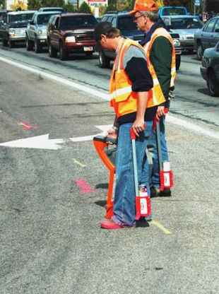
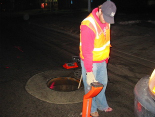
QL-B Utility Designating:
Benefits: Implementing Quality Level 'B' designating services to your project allows you as the Project Engineer/Designer to know precisely where the existing underground utilities are horizontally. It provides you with a greater sense of understanding and functionality of the existing utilities which in turn allows you to design a better product, by designing around the existing conditions. You no longer have to rely upon inaccurate or incomplete utility as-builds as provided by the utility owner, or the generalities and sometimes inaccurate locations supplied by One-Call agencies.
SUE Solutions uses nondestructive geophysical prospecting techniques to determine the existence and horizontal position of underground utilities following ASCE Guidelines 38-02. This includes certification of accuracy to one foot horizontally. Precisely locating underground utilities helps to plan for proper protection, and reduce or eliminate potential damage to underground facilities during construction and can avoid unnecessary relocations. A heavy emphasis is ALWAYS placed on quality control and quality assurance by incorporating systematic reviews of data collection by independent / qualified reviewers to ensure the competency and accuracy of the data. To accomplish the utility designating tasks, SUE Solutions uses of a wide array of state of the art instruments to designate ("locate") utilities at various stages of SUE exploration. Some of these instruments available to us are as follows:
- Electromagnetic - Electronic pipe and cable locating equipment utilized to determine the location of underground pipes, metallic conduits, and cables. The locating devices are used to "hook up" to individual utilities and trace out the horizontal location.
- Pulse Induction - The use of a "sonde" which can be used if an inlet and an outlet for the utility exists. Uses a pulse which travels through the facility. The operator uses an instrument to follow the pulse along the path of the utility.
- Ground Penetrating Radar (GPR) - Use of radar to scan a corridor or congested area. The data is processed through CAD to identify depth and size of facilities.
Accuracy: SUE Solutions places a very high standard on its employees to ensure that the horizontal positioning as supplied by the Quality Level 'B' designating services are complete and correct. The accuracy level of the supplied designating data can be defined as.±. 1 foot in X and Y directions of the location designated and marked in the field.
Deliverables: As a deliverable for this service, SUE Solutions will provide a report of its findings in the field (general locations and limitations), project photographs (of QL-B markings), survey data (should that be part of the initial Scope), existing utility owner mapping, and digital data/mapping should it be requested.